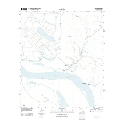
2012 Map of Angola
USGS Topo · Published 2012About this map
The Louisiana State Penitentiary dominates the alluvial landscape at the bend of the Mississippi River in this 2012 survey. Organized around multiple outposts like Camp A, Camp B, and Camp H, the prison grounds occupy the flat, bayou-threaded terrain north of Tunica Bend. The map illustrates the site's unique geography, bounded by the river to the south and the rising Tunica Hills to the east, which hem in Lake Killarney and the Angola Airstrip.
Find a feature on this map
62 named features on this map. Tap any name to fly to it.
Don’t see what you’re looking for? This feature index may not catch every label — zoom into the map to look around manually.
Map Details
Editions of this 2012 Angola Map
This is the sole edition of this map. No revisions or reprints were ever made.
Other maps of this area

1906 · Bayou Sara
USGS Topo · 1:125,000

1936 · Woodville
USGS Topo · 1:62,500

1939 · St. Francisville
USGS Topo · 1:62,500

1939 · Artonish
USGS Topo · 1:62,500

1941 · Batchelor
USGS Topo · 1:62,500

1953 · Natchez
USGS Topo · 1:250,000

1954 · Artonish
USGS Topo · 1:62,500

1954 · Baton Rouge
USGS Topo · 1:250,000

1955 · Artonish
USGS Topo · 1:62,500

1955 · Batchelor
USGS Topo · 1:62,500