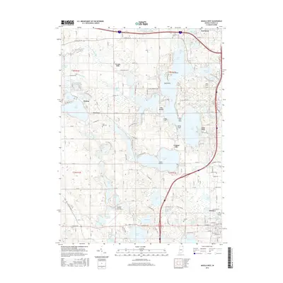
2016 Map of Angola West
USGS Topo · Published 2016About this map
Angola and the expansive glacial lake district of Steuben County dominate this 2016 survey, showcasing a landscape defined by water and recreation. Large lake systems like Lake James and Crooked Lake are intricately detailed, featuring named points of land such as Deer Island, Eagle Island, and Lone Tree Point. The city of Angola is visible in the southeast, anchored by the Trine Univ campus and historical sites like Old Circle Hill Cem.
Find a feature on this map
107 named features on this map. Tap any name to fly to it.
Don’t see what you’re looking for? This feature index may not catch every label — zoom into the map to look around manually.
Map Details
Editions of this 2016 Angola West Map
This is the sole edition of this map. No revisions or reprints were ever made.
Other maps of this area

1939 · Hamilton
USGS Topo · 1:24,000

1939 · Angola East
USGS Topo · 1:24,000

1940 · Orland
USGS Topo · 1:24,000

1941 · Orland
USGS Topo · 1:24,000

1941 · Angola West
USGS Topo · 1:24,000

1942 · Ashley
USGS Topo · 1:24,000

1942 · Angola West
USGS Topo · 1:24,000

1942 · Stroh
USGS Topo · 1:24,000

1947 · Angola East
USGS Topo · 1:24,000

1948 · Hamilton
USGS Topo · 1:24,000