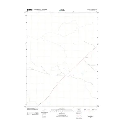
2011 Map of Angora NE
USGS Topo · Published 2011About this map
The High Plains of Morrill County are captured here in a period of relative isolation, characterized by the expansive grazing lands of the Nebraska Panhandle. The settlement of Bonner serves as the primary focal point along a diagonal transit corridor that bisects the landscape. This region, defined by its sparse human footprint, relies on a network of rural routes such as N Co Rd to connect remote ranching operations. The topography is subtle, dominated by dry drainage patterns and the broad, open geography typical of the western edge of the Great Plains during the early twenty-first century.
Find a feature on this map
2 named features on this map. Tap any name to fly to it.
Don’t see what you’re looking for? This feature index may not catch every label — zoom into the map to look around manually.
Map Details
Editions of this 2011 Angora NE Map
This is the sole edition of this map. No revisions or reprints were ever made.
Other maps of this area

1896 · Browns Creek
USGS Topo · 1:125,000

1898 · Camp Clarke
USGS Topo · 1:125,000

1899 · Browns Creek
USGS Topo · 1:125,000

1947 · Bronco Lake
USGS Topo · 1:24,000

1948 · Hemingford 4 SW
USGS Topo · 1:24,000

1948 · Hemingford 4 SE
USGS Topo · 1:24,000

1949 · Lynn
USGS Topo · 1:62,500
1949 · Bronco Lake
USGS Topo · 1:24,000

1954 · Scottsbluff
USGS Topo · 1:250,000

1955 · Alliance
USGS Topo · 1:250,000