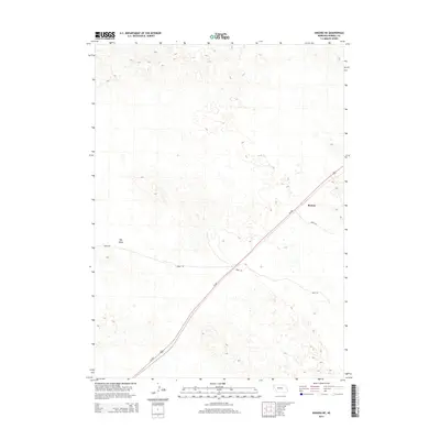
2014 Map of Angora NE
USGS Topo · Published 2014About this map
Hay Valley occupies the western portion of this landscape in Morrill County, Nebraska, characterizing a region defined by its wide, open terrain and specialized rural road network. The small settlement of Bonner serves as a primary reference point in the east, situated where Us-385 cuts diagonally across the prairie. This corridor, supported by local routes like Road 126 and Road 130, illustrates the modern logistical framework of the High Plains. The geography recorded here by the U.S. Geological Survey reflects a sparsely populated area where large-scale land divisions and topographic contours delineate the subtle shifts in the western Nebraska panhandle.
Find a feature on this map
6 named features on this map. Tap any name to fly to it.
Don’t see what you’re looking for? This feature index may not catch every label — zoom into the map to look around manually.
Map Details
Editions of this 2014 Angora NE Map
This is the sole edition of this map. No revisions or reprints were ever made.
Other maps of this area

1896 · Browns Creek
USGS Topo · 1:125,000

1898 · Camp Clarke
USGS Topo · 1:125,000

1899 · Browns Creek
USGS Topo · 1:125,000

1947 · Bronco Lake
USGS Topo · 1:24,000

1948 · Hemingford 4 SW
USGS Topo · 1:24,000

1948 · Hemingford 4 SE
USGS Topo · 1:24,000

1949 · Lynn
USGS Topo · 1:62,500
1949 · Bronco Lake
USGS Topo · 1:24,000

1954 · Scottsbluff
USGS Topo · 1:250,000

1955 · Alliance
USGS Topo · 1:250,000