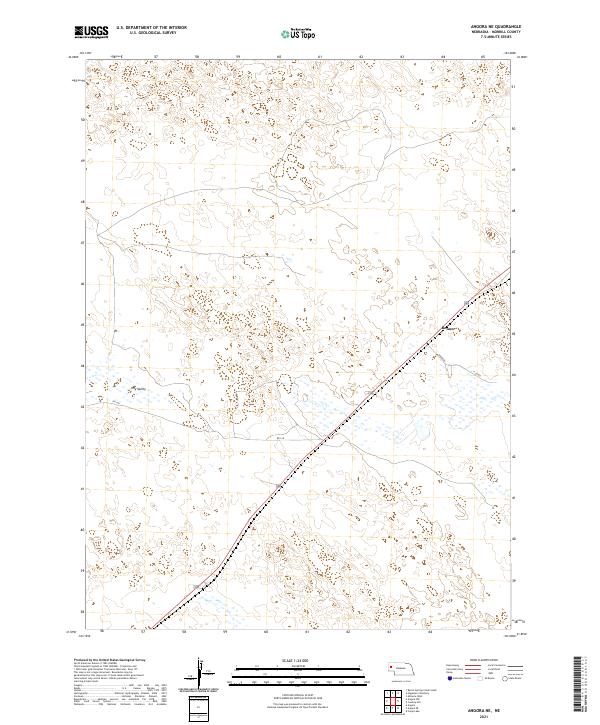
2021 Map of Angora NE
USGS Topo · Published 2021About this map
Hay Valley occupies the central portion of this Morrill County landscape, where the Nebraska panhandle's characteristic undulating terrain is marked by numerous small depressions and drainage patterns. The settlement of Bonner serves as a primary reference point in the eastern half of the map, situated at a junction where Daharsh road meets the northwest-trending rail corridor. This 2021 survey by the U.S. Geological Survey details a rural infrastructure defined by section-line roads like RD 128 and N Co Rd, reflecting the enduring Public Land Survey System framework. The map provides a clear view of the topographic contours and localized water features that define the region's agricultural and ranching layout.
Find a feature on this map
9 named features on this map. Tap any name to fly to it.
Don’t see what you’re looking for? This feature index may not catch every label — zoom into the map to look around manually.
Map Details
Editions of this 2021 Angora NE Map
This is the sole edition of this map. No revisions or reprints were ever made.
Other maps of this area

1896 · Browns Creek
USGS Topo · 1:125,000

1898 · Camp Clarke
USGS Topo · 1:125,000

1899 · Browns Creek
USGS Topo · 1:125,000

1947 · Bronco Lake
USGS Topo · 1:24,000

1948 · Hemingford 4 SW
USGS Topo · 1:24,000

1948 · Hemingford 4 SE
USGS Topo · 1:24,000

1949 · Lynn
USGS Topo · 1:62,500
1949 · Bronco Lake
USGS Topo · 1:24,000

1954 · Scottsbluff
USGS Topo · 1:250,000

1955 · Alliance
USGS Topo · 1:250,000