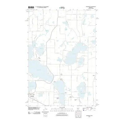
2010 Map of Annandale
USGS Topo · Published 2010About this map
Annandale anchors this map of central Minnesota lake country, shown here at the start of the 21st century. The city's residential grid extends north toward the Annandale Post Office and Woodlawn Cemetery, while the surrounding landscape is defined by an intricate network of glaciated water bodies. Large recreational and residential lakes dominate the topography, including the expansive Clearwater Lake, Sugar Lake, and Cedar Lake, which is controlled by the Cedar Lake Dam.
Find a feature on this map
53 named features on this map. Tap any name to fly to it.
Don’t see what you’re looking for? This feature index may not catch every label — zoom into the map to look around manually.
Map Details
Editions of this 2010 Annandale Map
This is the sole edition of this map. No revisions or reprints were ever made.
Other maps of this area

1951 · Annandale
USGS Topo · 1:62,500

1953 · Saint Cloud
USGS Topo · 1:250,000

1953 · Stillwater
USGS Topo · 1:250,000

1955 · Stillwater
USGS Topo · 1:250,000

1957 · Saint Cloud
USGS Topo · 1:250,000

1958 · Stillwater
USGS Topo · 1:250,000

1958 · Saint Cloud
USGS Topo · 1:250,000

1958 · Buffalo
USGS Topo · 1:62,500

1958 · Cokato
USGS Topo · 1:62,500

1961 · Clear Lake
USGS Topo · 1:24,000
Featured Places
- Annandale, MN
- Clearwater Township, MN
- Silver Creek Township, MN
- Eastview Mobile Home Park, Annandale
- Lynden Township, MN