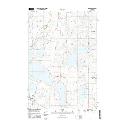
2016 Map of Annandale
USGS Topo · Published 2016About this map
The city of Annandale serves as the focal point for this landscape, which is heavily defined by its numerous glacial lakes and intricate drainage systems. Large water bodies such as Clearwater Lake and Sugar Lake dominate the terrain, reflecting the region's character as a premier Minnesota lake country destination. The map documents the established grid of the town, including streets like Hemlock St E and Chestnut St E, alongside outlying areas where rural cemetery sites like Woodlawn Cem and Saint Mark's Cem provide important genealogical markers for local families.
Find a feature on this map
110 named features on this map. Tap any name to fly to it.
Don’t see what you’re looking for? This feature index may not catch every label — zoom into the map to look around manually.
Map Details
Editions of this 2016 Annandale Map
This is the sole edition of this map. No revisions or reprints were ever made.
Other maps of this area

1951 · Annandale
USGS Topo · 1:62,500

1953 · Saint Cloud
USGS Topo · 1:250,000

1953 · Stillwater
USGS Topo · 1:250,000

1955 · Stillwater
USGS Topo · 1:250,000

1957 · Saint Cloud
USGS Topo · 1:250,000

1958 · Stillwater
USGS Topo · 1:250,000

1958 · Saint Cloud
USGS Topo · 1:250,000

1958 · Buffalo
USGS Topo · 1:62,500

1958 · Cokato
USGS Topo · 1:62,500

1961 · Clear Lake
USGS Topo · 1:24,000
Featured Places
- Annandale, MN
- Clearwater Township, MN
- Silver Creek Township, MN
- Eastview Mobile Home Park, Annandale
- Lynden Township, MN