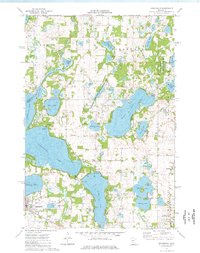
1974 Map of Annandale
USGS Topo · Published 1976About this map
The glacial lakes of central Minnesota define the landscape in this 1970s survey of Stearns and Wright counties. The settlement of Annandale serves as a hub, positioned along the Soo Line railroad and near the waters of Pleasant Lake. The map reveals a high density of recreation and conservation land, including Camp Friendship on the shores of Clearwater Lake and Camp Courage on Cedar Lake. Large protected tracts such as the Sunfish Lake Wildlife Management Area and Hoglund State Wildlife Management Area flank the eastern waters, illustrating the region's commitment to preserving wetlands and wildlife habitats.
Find a feature on this map
47 named features on this map. Tap any name to fly to it.
Don’t see what you’re looking for? This feature index may not catch every label — zoom into the map to look around manually.
Map Details
Editions of this 1974 Annandale Map
This is the sole edition of this map. No revisions or reprints were ever made.
Other maps of this area

1951 · Annandale
USGS Topo · 1:62,500

1953 · Saint Cloud
USGS Topo · 1:250,000

1953 · Stillwater
USGS Topo · 1:250,000

1955 · Stillwater
USGS Topo · 1:250,000

1957 · Saint Cloud
USGS Topo · 1:250,000

1958 · Stillwater
USGS Topo · 1:250,000

1958 · Saint Cloud
USGS Topo · 1:250,000

1958 · Buffalo
USGS Topo · 1:62,500

1958 · Cokato
USGS Topo · 1:62,500

1961 · Clear Lake
USGS Topo · 1:24,000
Featured Places
- Annandale, MN
- Lynden Township, MN
- Clearwater Township, MN
- Silver Creek Township, MN
- Maple Lake Township, MN