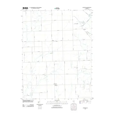
2012 Map of Annapolis
USGS Topo · Published 2012About this map
Annapolis anchors the southern portion of this Clark County landscape, a rural Illinois community defined by a strict section-line road grid and several established burial grounds. The geography is etched by the drainage systems of Muddy Cr and Raccoon Cr, which break the geometric precision of the farm plots. Smaller settlements like Orange and Melrose are linked by thoroughfares such as E 500th Rd and N 1000th St, while several cemeteries including Wesley Chapel Cem, Olive Branch Cem, and Medsker Cem provide critical touchpoints for family historians and local genealogists. In the northeastern corner, Craig Lake and N Fork Raccoon Cr introduce localized variation to the terrain. This record of the early twenty-first century documents the enduring agricultural character of the region, showing the persistency of small rural hubs and post offices in the modern era.
Find a feature on this map
64 named features on this map. Tap any name to fly to it.
Don’t see what you’re looking for? This feature index may not catch every label — zoom into the map to look around manually.
Map Details
Editions of this 2012 Annapolis Map
This is the sole edition of this map. No revisions or reprints were ever made.
Other maps of this area

1932 · Marshall
USGS Topo · 1:62,500

1936 · Casey
USGS Topo · 1:48,000

1937 · Marshall
USGS Topo · 1:62,500

1942 · Casey
USGS Topo · 1:62,500

1943 · Casey
USGS Topo · 1:62,500

1953 · Indianapolis
USGS Topo · 1:250,000

1956 · Indianapolis
USGS Topo · 1:250,000

1956 · Annapolis
USGS Topo · 1:62,500

1957 · Indianapolis
USGS Topo · 1:250,000

1957 · Hutsonville
USGS Topo · 1:62,500