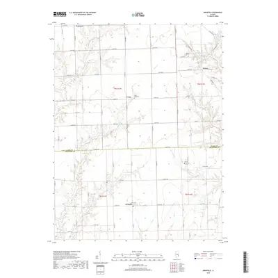
2018 Map of Annapolis
USGS Topo · Published 2018About this map
Annapolis and the surrounding borderlands of Clark and Crawford Counties are defined by a network of rural roads and meandering creek beds. This 2018 survey reveals a landscape dotted with small family and community burial grounds, including Dix Cem, Medsker Cem, and Wesley Chapel Cem, which serve as primary markers for the early families of settlements like Melrose and Orange. The terrain is drained by several branches of Raccoon Cr and the waters of Muddy Cr, which carve subtle valleys through the agricultural grid. In the northern reaches, Neadmore sits near the headwaters of Willow Cr. This map preserves the contemporary spatial relationship between these unincorporated communities, showing how decades of land division and road development have shaped the eastern Illinois countryside while maintaining a distinct rural character centered around long-standing crossroads.
Find a feature on this map
45 named features on this map. Tap any name to fly to it.
Don’t see what you’re looking for? This feature index may not catch every label — zoom into the map to look around manually.
Map Details
Editions of this 2018 Annapolis Map
This is the sole edition of this map. No revisions or reprints were ever made.
Other maps of this area

1932 · Marshall
USGS Topo · 1:62,500

1936 · Casey
USGS Topo · 1:48,000

1937 · Marshall
USGS Topo · 1:62,500

1942 · Casey
USGS Topo · 1:62,500

1943 · Casey
USGS Topo · 1:62,500

1953 · Indianapolis
USGS Topo · 1:250,000

1956 · Indianapolis
USGS Topo · 1:250,000

1956 · Annapolis
USGS Topo · 1:62,500

1957 · Indianapolis
USGS Topo · 1:250,000

1957 · Hutsonville
USGS Topo · 1:62,500