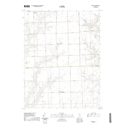
2021 Map of Annapolis
USGS Topo · Published 2021About this map
Annapolis and Melrose anchor this rural landscape along the boundary of Clark and Crawford counties. This agricultural region is defined by a dense network of country roads, including Co Hwy 19 and Co Hwy 11, which connect small unincorporated settlements like Orange and Neadmore. Genealogists and local historians will find significant value in the documentation of several family and community burial sites, such as Medsker Cem, Wesley Chapel Cem, and Dix Cem. The terrain is drained by numerous winding waterways, including Muddy Cr, Big Cr, and the N Fork Raccoon Cr. To the northeast, the presence of Craig Lake stands as a notable water feature amidst the rolling prairie and creek bottoms that characterize this part of eastern Illinois.
Find a feature on this map
63 named features on this map. Tap any name to fly to it.
Don’t see what you’re looking for? This feature index may not catch every label — zoom into the map to look around manually.
Map Details
Editions of this 2021 Annapolis Map
This is the sole edition of this map. No revisions or reprints were ever made.
Other maps of this area

1932 · Marshall
USGS Topo · 1:62,500

1936 · Casey
USGS Topo · 1:48,000

1937 · Marshall
USGS Topo · 1:62,500

1942 · Casey
USGS Topo · 1:62,500

1943 · Casey
USGS Topo · 1:62,500

1953 · Indianapolis
USGS Topo · 1:250,000

1956 · Indianapolis
USGS Topo · 1:250,000

1956 · Annapolis
USGS Topo · 1:62,500

1957 · Indianapolis
USGS Topo · 1:250,000

1957 · Hutsonville
USGS Topo · 1:62,500