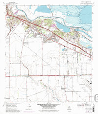
1969 Map of Annaville
USGS Topo · Published 1977About this map
Industrial expansion and coastal infrastructure define this region of the Texas Gulf Coast as it appeared in the late 1960s and mid-1970s. The Nueces River and Nueces Bay serve as the focal point for heavy transport and energy production, featuring the Viola Turning Basin and the deep-water Viola Channel. The landscape is dominated by the sprawling Saxet Oil Field, which is crisscrossed by an extensive network of pipelines and service roads like Bockholt Road and Mc Gloin Road.
Find a feature on this map
48 named features on this map. Tap any name to fly to it.
Don’t see what you’re looking for? This feature index may not catch every label — zoom into the map to look around manually.
Map Details
Editions of this 1969 Annaville Map
3 editions found
Other maps of this area

1924 · Petronilla
USGS Topo · 1:62,500

1925 · Robstown
USGS Topo · 1:62,500

1925 · Oso Creek
USGS Topo · 1:62,500

1925 · Corpus Christi
USGS Topo · 1:62,500

1950 · Corpus Christi
USGS Topo · 1:250,000

1951 · Corpus Christi
USGS Topo · 1:24,000

1951 · Corpus Christi
USGS Topo · 1:62,500

1951 · Oso Creek NW
USGS Topo · 1:24,000

1951 · Oso Creek
USGS Topo · 1:62,500

1954 · Robstown
USGS Topo · 1:62,500
Featured Places
- Corpus Christi, TX
- Violet, TX
- Clarkwood, Corpus Christi
- McNorton, Corpus Christi
- San Juan, Corpus Christi