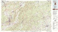
1981 Map of Anniston
USGS Topo · Published 1982About this map
The ridge-and-valley landscape of the Talladega Mountains dominates this 1980s-era topographic study, highlighting the intersection of heavy military presence and industrial transport hubs across the Alabama and Georgia border. The sprawl of Anniston and Jacksonville is defined by the massive footprint of the Fort Mc Clellan Military Reservation and the nearby Anniston Ordnance Depot, which anchor the local economy alongside major rail corridors like the Southern Railway and the Seaboard Coast Line RR.
Find a feature on this map
146 named features on this map. Tap any name to fly to it.
Don’t see what you’re looking for? This feature index may not catch every label — zoom into the map to look around manually.
Map Details
Editions of this 1981 Anniston Map
2 editions found
Other maps of this area

1885 · Gadsden
USGS Topo · 1:125,000

1886 · Rome
USGS Topo · 1:125,000

1888 · Gadsden
USGS Topo · 1:125,000

1889 · Tallapoosa
USGS Topo · 1:125,000

1889 · Springville
USGS Topo · 1:125,000

1890 · Cartersville
USGS Topo · 1:125,000

1890 · Talladega
USGS Topo · 1:125,000

1891 · Marietta
USGS Topo · 1:125,000

1891 · Cartersville
USGS Topo · 1:125,000

1891 · Ashland
USGS Topo · 1:125,000