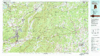
1981 Map of Anniston
USGS Topo · Published 1982About this map
Anniston and the surrounding industrial corridor of Northeast Alabama serve as the focal point for this early 1980s regional study. The map illustrates a landscape defined by significant federal and industrial presence, notably the Fort McClellan Military Reservation and the Anniston Ordnance Depot. To the east, the terrain transitions into the heavily forested ridges of the Talladega National Forest and Cheaha State Park, where the high peaks of Choccolocco Mountain and Brymer Mountain dominate the geography.
Find a feature on this map
156 named features on this map. Tap any name to fly to it.
Don’t see what you’re looking for? This feature index may not catch every label — zoom into the map to look around manually.
Map Details
Editions of this 1981 Anniston Map
2 editions found
Other maps of this area

1885 · Gadsden
USGS Topo · 1:125,000

1886 · Rome
USGS Topo · 1:125,000

1888 · Gadsden
USGS Topo · 1:125,000

1889 · Tallapoosa
USGS Topo · 1:125,000

1889 · Springville
USGS Topo · 1:125,000

1890 · Cartersville
USGS Topo · 1:125,000

1890 · Talladega
USGS Topo · 1:125,000

1891 · Marietta
USGS Topo · 1:125,000

1891 · Cartersville
USGS Topo · 1:125,000

1891 · Ashland
USGS Topo · 1:125,000