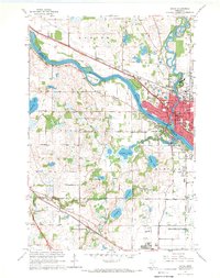
1967 Map of Anoka
USGS Topo · Published 1969About this map
The Mississippi River creates a natural divide between the bustling city of Anoka and the developing riverfront of Champlin during this late 1960s revision. This map records the dense urban character of Anoka, centered around its civic and educational heart with schools like Lincoln Sch and Washington Sch and the expansive grounds of the State Hospital. The landscape transitions from these established river towns into the suburban and rural fringes of Maple Grove and Brooklyn Park.
Find a feature on this map
55 named features on this map. Tap any name to fly to it.
Don’t see what you’re looking for? This feature index may not catch every label — zoom into the map to look around manually.
Map Details
Editions of this 1967 Anoka Map
4 editions found
Other maps of this area

1902 · Anoka
USGS Topo · 1:62,500

1909 · Rockford
USGS Topo · 1:62,500

1916 · St. Francis
USGS Topo · 1:62,500

1919 · St. Francis
USGS Topo · 1:62,500

1952 · Minneapolis North
USGS Topo · 1:24,000

1953 · Stillwater
USGS Topo · 1:250,000

1955 · Osseo
USGS Topo · 1:24,000

1955 · Anoka
USGS Topo · 1:24,000

1955 · Coon Rapids
USGS Topo · 1:24,000

1955 · Anoka
USGS Topo · 1:62,500