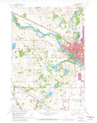
1967 Map of Anoka
USGS Topo · Published 1973About this map
Anoka sits at the confluence where the Mississippi River meets the local creek systems, serving as a hub for both industry and civic life. The Burlington Northern railroad cuts through the northern landscape, passing by the Anoka Industrial Airport and the expansive State Hospital grounds. This survey reflects a period of significant suburban expansion, with residential growth pushing into Champlin and Maple Grove. To the south, the Schmidt State Wildlife Management Areas preserve a stretch of wetlands and lakes, including Goose Lake and Mud Lake. Local history is anchored by numerous civic sites, from the County Fairground to several established burial grounds like Calvary Cem and Oakwood Cem. The map illustrates the transition from a river-centered town to a structured suburban network of schools like Lincoln Sch and parks such as Goodrich Park.
Find a feature on this map
67 named features on this map. Tap any name to fly to it.
Don’t see what you’re looking for? This feature index may not catch every label — zoom into the map to look around manually.
Map Details
Editions of this 1967 Anoka Map
4 editions found
Other maps of this area

1902 · Anoka
USGS Topo · 1:62,500

1909 · Rockford
USGS Topo · 1:62,500

1916 · St. Francis
USGS Topo · 1:62,500

1919 · St. Francis
USGS Topo · 1:62,500

1952 · Minneapolis North
USGS Topo · 1:24,000

1953 · Stillwater
USGS Topo · 1:250,000

1955 · Osseo
USGS Topo · 1:24,000

1955 · Anoka
USGS Topo · 1:24,000

1955 · Coon Rapids
USGS Topo · 1:24,000

1955 · Anoka
USGS Topo · 1:62,500