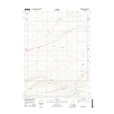
2015 Map of Antelope Flats
USGS Topo · Published 2015About this map
Antelope Flats and the surrounding high-desert plateaus of Sweetwater County are defined by a complex network of seasonal drainages and topographic landmarks in this 2015 study. The landscape is characterized by prominent escarpments such as Sixmile Rim and Sand Butte Rim, which overlook lower-lying basins like Hungry Hollow and Patrick Draw. Water sources, though sparse in this arid environment, are specifically identified at Antelope Springs and Barney Meadows Spring, indicating their importance for local livestock or wildlife.
Find a feature on this map
23 named features on this map. Tap any name to fly to it.
Don’t see what you’re looking for? This feature index may not catch every label — zoom into the map to look around manually.
Map Details
Editions of this 2015 Antelope Flats Map
This is the sole edition of this map. No revisions or reprints were ever made.
Other maps of this area

1954 · Rock Springs
USGS Topo · 1:250,000

1958 · Rock Springs
USGS Topo · 1:250,000

1962 · Rock Springs
USGS Topo · 1:250,000

1968 · Sand Butte Rim NW
USGS Topo · 1:24,000

1968 · Bitter Creek
USGS Topo · 1:24,000

1968 · Black Buttes
USGS Topo · 1:24,000

1968 · Pine Butte
USGS Topo · 1:24,000

1968 · Sand Butte Rim SE
USGS Topo · 1:24,000
1968 · Antelope Flats
USGS Topo · 1:24,000
1970 · Kinney Spring
USGS Topo · 1:24,000