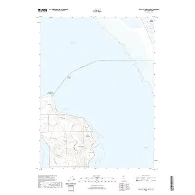
2020 Map of Antelope Island North
USGS Topo · Published 2020About this map
Antelope Island rises from the southeastern reaches of the Great Salt Lake, connected to the mainland by the Davis Co Cswy. This northern portion of the island features a landscape shaped by both natural springs and military commemoration, notably the Antelope Island Army Ranger and Air Force Memorial. The terrain transitions from the rocky point of Ladyfinger to the interior heights of Beacon Knob, revealing the distinct pastoral history of the area through names like Tin Lambing Shed Basin. To the east, the shoreline edges into Farmington Bay, while the Fremont Island Bar extends into the salt waters to the north. This modern survey details the primary access route via Antelope Island Rd, which services the recreational and historical sites concentrated around Buffalo Bay.
Find a feature on this map
20 named features on this map. Tap any name to fly to it.
Don’t see what you’re looking for? This feature index may not catch every label — zoom into the map to look around manually.
Map Details
Editions of this 2020 Antelope Island North Map
This is the sole edition of this map. No revisions or reprints were ever made.
Other maps of this area

1885 · Tooele Valley
USGS Topo · 1:250,000

1952 · Saltair NE
USGS Topo · 1:24,000

1953 · Tooele
USGS Topo · 1:250,000

1954 · Antelope Island
USGS Topo · 1:24,000

1954 · Antelope Island North
USGS Topo · 1:24,000

1954 · Brigham City
USGS Topo · 1:250,000

1955 · Clearfield
USGS Topo · 1:24,000

1955 · Roy
USGS Topo · 1:24,000

1955 · Ogden Bay
USGS Topo · 1:24,000

1955 · Fremont Island
USGS Topo · 1:24,000