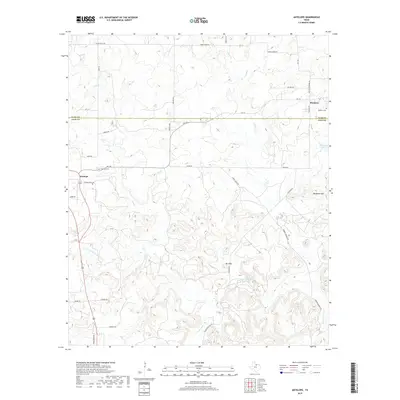
2019 Map of Antelope
USGS Topo · Published 2019About this map
Antelope serves as a central hub in this section of North Texas, where the border between Clay Co and Jack Co bisects the rural landscape. The settlement is defined by its connection to the W Fork Trinity River, which winds through the southern portion of the map, and a network of ranch-to-market roads like FM 175. To the northeast, the smaller community of Shannon sits near the county line, accompanied by Shannon Cem. This area is characterized by low relief punctuated by distinct elevations such as Backbone Mtn and Mt Lebo, which rise above the drainages of Lodge Cr and Flat Cr. Water resources are scattered throughout, including Ellenburg Lake and Smith Lake, supporting the local cattle and agricultural operations that define the regional economy in the late twenty-first century.
Find a feature on this map
38 named features on this map. Tap any name to fly to it.
Don’t see what you’re looking for? This feature index may not catch every label — zoom into the map to look around manually.
Map Details
Editions of this 2019 Antelope Map
This is the sole edition of this map. No revisions or reprints were ever made.
Other maps of this area

1954 · Wichita Falls
USGS Topo · 1:250,000

1958 · Wichita Falls
USGS Topo · 1:250,000

1962 · Windthorst
USGS Topo · 1:24,000

1962 · Antelope Creek NE
USGS Topo · 1:24,000

1964 · Johnson Lake
USGS Topo · 1:24,000

1964 · Darnell Branch
USGS Topo · 1:24,000

1964 · Lynn Creek
USGS Topo · 1:24,000

1964 · Antelope
USGS Topo · 1:24,000

1964 · Scotland SE
USGS Topo · 1:24,000
1964 · Postoak
USGS Topo · 1:24,000