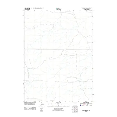
2012 Map of Antelope Knoll
USGS Topo · Published 2012About this map
Little Dry Creek meanders across this Sweetwater County landscape, defining the local drainage system in an area marked by a sparse network of unpaved roads and 4WD tracks. This 2012 survey by the U.S. Geological Survey details a high-desert environment where water sources like Chicken Spring were essential landmarks for navigation and land use. The map illustrates a predominantly open terrain where the topography is shaped by the subtle contours of Little Dry Creek, showing the persistence of traditional range-land features in the early 21st century. It serves as a clear record of the region's rural infrastructure, from basic transit routes to isolated natural springs.
Find a feature on this map
2 named features on this map. Tap any name to fly to it.
Don’t see what you’re looking for? This feature index may not catch every label — zoom into the map to look around manually.
Map Details
Editions of this 2012 Antelope Knoll Map
This is the sole edition of this map. No revisions or reprints were ever made.
Other maps of this area

1954 · Ogden
USGS Topo · 1:250,000

1954 · Rock Springs
USGS Topo · 1:250,000

1958 · Ogden
USGS Topo · 1:250,000

1958 · Rock Springs
USGS Topo · 1:250,000

1960 · Ogden
USGS Topo · 1:250,000

1961 · Little America
USGS Topo · 1:24,000

1961 · Granger
USGS Topo · 1:24,000

1962 · Rock Springs
USGS Topo · 1:250,000

1964 · Butcher Knife Draw
USGS Topo · 1:24,000

1964 · Antelope Knoll NE
USGS Topo · 1:24,000