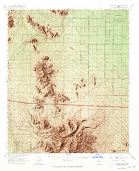
1963 Map of Antelope Peak
USGS Topo · Published 1965About this map
Antelope Mountains dominate the southern half of this 1963 landscape, anchored by the prominent Antelope Peak and the sharp profile of Needle Peak. To the north, the terrain transitions into the broad alluvial expanses of Hidden Valley and Vekol Valley, where Vekol Wash carves a drainage path across the desert floor. The map documents a period of mid-century infrastructure expansion, most notably a highway marked as Under Construction stretching across the central plains near the settlement of Antelope.
Find a feature on this map
29 named features on this map. Tap any name to fly to it.
Don’t see what you’re looking for? This feature index may not catch every label — zoom into the map to look around manually.
Map Details
Editions of this 1963 Antelope Peak Map
4 editions found
Other maps of this area

1913 · Maricopa
USGS Topo · 1:62,500

1914 · Gila Butte
USGS Topo · 1:62,500

1915 · Maricopa
USGS Topo · 1:62,500

1917 · Gila Butte
USGS Topo · 1:62,500

1922 · Casa Grande
USGS Topo · 1:62,500

1924 · Casa Grande
USGS Topo · 1:62,500

1941 · Vekol Mountains
USGS Topo · 1:62,500

1942 · Silver Reef Mountains
USGS Topo · 1:62,500

1942 · Vekol Mountains
USGS Topo · 1:62,500

1946 · Antelope Peak
USGS Topo · 1:62,500