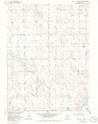
1951 Map of Antelope Springs
USGS Topo · Published 1984About this map
The high plains of Morgan County are defined by an intricate network of irrigation infrastructure and rural landmarks in this 1951 survey. Near the center of the sheet, the Antelope Springs Church serves as a community anchor for the Antelope Springs settlement, while the surrounding landscape is dotted with numerous water-drawing points like Windmill 4446 and Windmill 4511. The mapping of education history is evident in the transition of several local facilities, including the Gilliland School (Aban'd) and Brammer Sch (Aban'd), reflecting shifts in rural population during the mid-century.
Find a feature on this map
27 named features on this map. Tap any name to fly to it.
Don’t see what you’re looking for? This feature index may not catch every label — zoom into the map to look around manually.
Map Details
Editions of this 1951 Antelope Springs Map
3 editions found
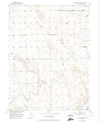
Other maps of this area

1951 · Dead Horse Springs
USGS Topo · 1:24,000

1951 · Willard
USGS Topo · 1:24,000

1951 · Messex
USGS Topo · 1:24,000

1951 · Brush West
USGS Topo · 1:24,000

1951 · Antelope Springs
USGS Topo · 1:24,000

1951 · Merino SW
USGS Topo · 1:24,000

1951 · Brush East
USGS Topo · 1:24,000

1954 · Sterling
USGS Topo · 1:250,000

1958 · Sterling
USGS Topo · 1:250,000

1971 · Brush East
USGS Topo · 1:24,000