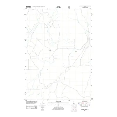
2011 Map of Antelope Valley
USGS Topo · Published 2011About this map
Antelope Valley serves as a geographic centerpiece for this corner of eastern Idaho, where a complex network of seasonal and perennial waterways converge. The landscape is defined by the drainage patterns of Moose Creek and Dry Creek, which snake across the floor of the valley toward the rising elevations of Antelope Ridge. This 2011 survey documents a remote ranching and grazing corridor, evidenced by the prevalence of named county roads and local routes rather than dense township developments.
Find a feature on this map
15 named features on this map. Tap any name to fly to it.
Don’t see what you’re looking for? This feature index may not catch every label — zoom into the map to look around manually.
Map Details
Editions of this 2011 Antelope Valley Map
This is the sole edition of this map. No revisions or reprints were ever made.
Other maps of this area

1950 · Lower Red Rock Lake
USGS Topo · 1:62,500

1950 · Upper Red Rock Lake
USGS Topo · 1:62,500

1955 · Ashton
USGS Topo · 1:250,000

1958 · Ashton
USGS Topo · 1:250,000

1960 · Ashton
USGS Topo · 1:250,000

1965 · Crystal Butte
USGS Topo · 1:24,000

1965 · Sheridan Reservoir
USGS Topo · 1:24,000

1972 · Pine Butte
USGS Topo · 1:24,000

1972 · Antelope Valley
USGS Topo · 1:24,000

1972 · Kilgore
USGS Topo · 1:24,000