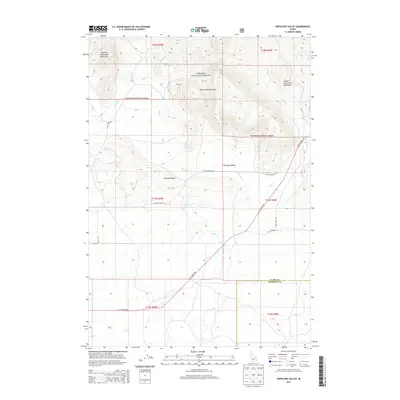
2013 Map of Antelope Valley
USGS Topo · Published 2013About this map
The Centennial Mountains define the northern horizon of this high-altitude landscape, where the Targhee National Forest protects a complex network of ridges and drainages. The area is dominated by the broad expanse of Antelope Valley, a significant topographical depression situated between Antelope Ridge and the mountain slopes. This 2013 survey illustrates a landscape primarily shaped by natural watercourses such as Moose Cr and Dry Cr, which flow from the higher elevations of the Western Centennial Mountains and Eastern Centennial Mountains.
Find a feature on this map
28 named features on this map. Tap any name to fly to it.
Don’t see what you’re looking for? This feature index may not catch every label — zoom into the map to look around manually.
Map Details
Editions of this 2013 Antelope Valley Map
This is the sole edition of this map. No revisions or reprints were ever made.
Other maps of this area

1950 · Lower Red Rock Lake
USGS Topo · 1:62,500

1950 · Upper Red Rock Lake
USGS Topo · 1:62,500

1955 · Ashton
USGS Topo · 1:250,000

1958 · Ashton
USGS Topo · 1:250,000

1960 · Ashton
USGS Topo · 1:250,000

1965 · Crystal Butte
USGS Topo · 1:24,000

1965 · Sheridan Reservoir
USGS Topo · 1:24,000

1972 · Pine Butte
USGS Topo · 1:24,000

1972 · Antelope Valley
USGS Topo · 1:24,000

1972 · Kilgore
USGS Topo · 1:24,000