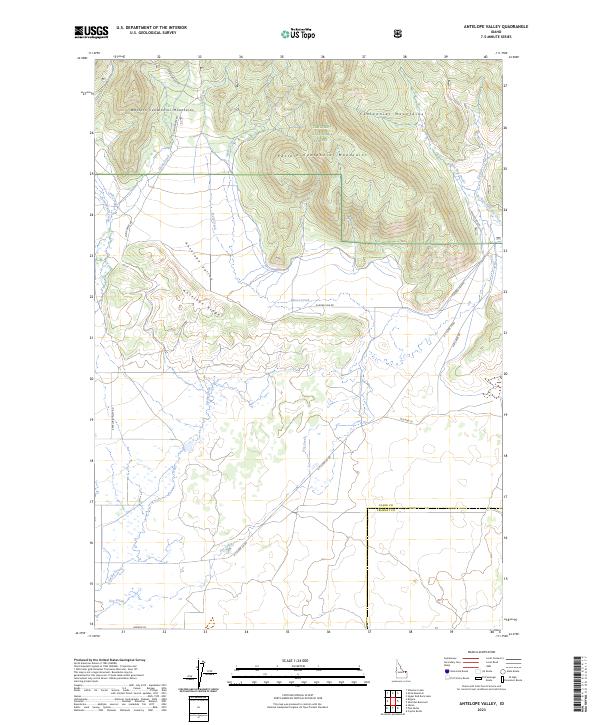
2023 Map of Antelope Valley
USGS Topo · Published 2023About this map
The Western Centennial Mountains and Eastern Centennial Mountains dominate the northern landscape of this Clark County survey, falling within the protected bounds of the Targhee National Forest. Below the high peaks, the terrain transitions into the Antelope Valley, a broad drainage basin defined by the Antelope Ridge and a complex network of seasonal and perennial watercourses. Hydrological features like Moose Creek, Scalp Creek, and Little Cottonwood Creek flow from the heights, eventually feeding into the prominent Dry Creek system that cuts southwest across the valley floor. Transportation in this high-altitude cattle and timber country relies on a handful of established routes, including the Kilgore-Yale Rd and Old Hwy 22, which follow the natural contours of the basin near the border of Clark and Fremont Counties.
Find a feature on this map
28 named features on this map. Tap any name to fly to it.
Don’t see what you’re looking for? This feature index may not catch every label — zoom into the map to look around manually.
Map Details
Editions of this 2023 Antelope Valley Map
This is the sole edition of this map. No revisions or reprints were ever made.
Other maps of this area

1950 · Lower Red Rock Lake
USGS Topo · 1:62,500

1950 · Upper Red Rock Lake
USGS Topo · 1:62,500

1955 · Ashton
USGS Topo · 1:250,000

1958 · Ashton
USGS Topo · 1:250,000

1960 · Ashton
USGS Topo · 1:250,000

1965 · Crystal Butte
USGS Topo · 1:24,000

1965 · Sheridan Reservoir
USGS Topo · 1:24,000

1972 · Pine Butte
USGS Topo · 1:24,000

1972 · Antelope Valley
USGS Topo · 1:24,000

1972 · Kilgore
USGS Topo · 1:24,000