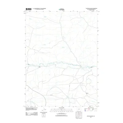
2012 Map of Antelope Wash
USGS Topo · Published 2012About this map
Washam stands as a focal point in this high-desert landscape of Sweetwater County, where the winding course of Henrys Fork cuts through the terrain. The water management of this arid region is clearly visible through a series of local impoundments including Silt Reservoir, Middle Reservoir, Neff Reservoir, and Briggs Reservoir. These features, along with Antelope Spring, highlight the essential infrastructure required for ranching and survival in the high plains. The map details the complex drainage patterns of Antelope Wash and the distinct topographical depressions of Big Hollow and Logan Hollow. Transportation in the area relies on the network established by Washam Rd and Co Rd 13, which provide access across the creeks and draws of this ranching country near the Wyoming-Utah border.
Find a feature on this map
16 named features on this map. Tap any name to fly to it.
Don’t see what you’re looking for? This feature index may not catch every label — zoom into the map to look around manually.
Map Details
Editions of this 2012 Antelope Wash Map
This is the sole edition of this map. No revisions or reprints were ever made.
Other maps of this area

1885 · Ashley
USGS Topo · 1:250,000

1906 · Marsh Peak
USGS Topo · 1:125,000

1908 · Marsh Peak
USGS Topo · 1:125,000

1954 · Vernal
USGS Topo · 1:250,000

1954 · Rock Springs
USGS Topo · 1:250,000

1958 · Vernal
USGS Topo · 1:250,000

1958 · Rock Springs
USGS Topo · 1:250,000

1960 · Vernal
USGS Topo · 1:250,000

1962 · Rock Springs
USGS Topo · 1:250,000
1963 · Manila
USGS Topo · 1:24,000