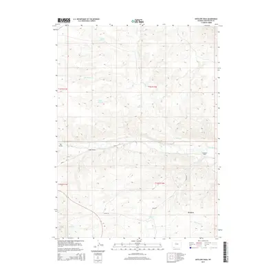
2015 Map of Antelope Wash
USGS Topo · Published 2015About this map
Washam is the primary point of settlement in this southern Sweetwater County landscape, situated where the high desert terrain meets the water system of the Henrys Fork. The map documents a complex network of water management essential for ranching and agriculture in this arid region, featuring a series of catchments including Briggs Reservoir, Silk Reservoir, Middle Reservoir, and Neff Reservoir.
Find a feature on this map
20 named features on this map. Tap any name to fly to it.
Don’t see what you’re looking for? This feature index may not catch every label — zoom into the map to look around manually.
Map Details
Editions of this 2015 Antelope Wash Map
This is the sole edition of this map. No revisions or reprints were ever made.
Other maps of this area

1885 · Ashley
USGS Topo · 1:250,000

1906 · Marsh Peak
USGS Topo · 1:125,000

1908 · Marsh Peak
USGS Topo · 1:125,000

1954 · Vernal
USGS Topo · 1:250,000

1954 · Rock Springs
USGS Topo · 1:250,000

1958 · Vernal
USGS Topo · 1:250,000

1958 · Rock Springs
USGS Topo · 1:250,000

1960 · Vernal
USGS Topo · 1:250,000

1962 · Rock Springs
USGS Topo · 1:250,000
1963 · Manila
USGS Topo · 1:24,000