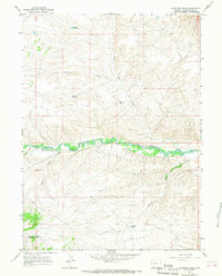
1964 Map of Antelope Wash
USGS Topo · Published 1968About this map
Henrys Fork snakes across this high desert landscape, providing a narrow band of riparian vegetation amidst the arid terrain of Sweetwater County. The 1964 field survey reveals a region defined by water management and drainage patterns, where small catchments like Silt Reservoir, Briggs Reservoir, and Middle Reservoir highlight the necessity of collecting seasonal runoff in this environment. To the south, Antelope Wash and Antelope Spring mark the subtle hydrological shifts that influenced land use during the mid-20th century.
Find a feature on this map
14 named features on this map. Tap any name to fly to it.
Don’t see what you’re looking for? This feature index may not catch every label — zoom into the map to look around manually.
Map Details
Editions of this 1964 Antelope Wash Map
2 editions found
Other maps of this area

1885 · Ashley
USGS Topo · 1:250,000

1906 · Marsh Peak
USGS Topo · 1:125,000

1908 · Marsh Peak
USGS Topo · 1:125,000

1954 · Vernal
USGS Topo · 1:250,000

1954 · Rock Springs
USGS Topo · 1:250,000

1958 · Vernal
USGS Topo · 1:250,000

1958 · Rock Springs
USGS Topo · 1:250,000

1960 · Vernal
USGS Topo · 1:250,000

1962 · Rock Springs
USGS Topo · 1:250,000
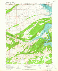
1963 · Manila
USGS Topo · 1:24,000