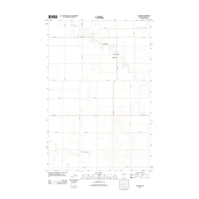
2013 Map of Anthony
USGS Topo · Published 2013About this map
Anthony serves as the central point of this Norman County landscape, where the winding course of the Marsh River creates a serpentine pattern across the prairie. The area’s spiritual and genealogical history is concentrated along this waterway, marked by several burial sites including the Anthony Cem, E Marsh River Cem, and the uniquely named W Petri-East Marsh River Cem. The infrastructure of the Red River Valley is evident in the transition from natural watercourses to managed systems like the State Ditch Number Sixty-eight, which cuts across the northern reaches. To the south, the Concordia Menighed Cem sits near the intersection of 170th St, anchored by a grid of agricultural roads and the primary east-west corridor of MN-200.
Find a feature on this map
18 named features on this map. Tap any name to fly to it.
Don’t see what you’re looking for? This feature index may not catch every label — zoom into the map to look around manually.
Map Details
Editions of this 2013 Anthony Map
This is the sole edition of this map. No revisions or reprints were ever made.
Other maps of this area

1918 · Hendrum
USGS Topo · 1:62,500

1924 · Ada
USGS Topo · 1:62,500

1952 · Grand Forks
USGS Topo · 1:250,000

1956 · Grand Forks
USGS Topo · 1:250,000

1963 · Shelly
USGS Topo · 1:24,000

1963 · Perley
USGS Topo · 1:24,000

1963 · Halstad
USGS Topo · 1:24,000

1965 · Lockhart
USGS Topo · 1:24,000

1965 · Anthony
USGS Topo · 1:24,000
1965 · Ada NW
USGS Topo · 1:24,000