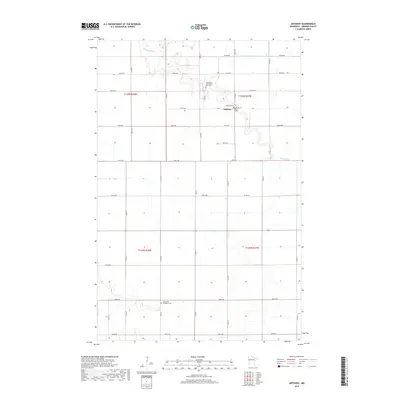
2019 Map of Anthony
USGS Topo · Published 2019About this map
Anthony and its surrounding agricultural township are defined by the meandering course of the Marsh River as it winds through this portion of Norman County. The landscape is structured by a precise grid of rural roads, including 180th St and 240th Ave, which serve the scattered farmsteads of the Red River Valley. This 2019 survey highlights a significant concentration of local heritage sites, particularly for genealogists researching the area's early settlement. Several well-preserved burial grounds are documented, such as the Anthony Cem, the East Marsh River Cem, and the Concordia Menighed Cem. The presence of the State-Ditch-Number-Sixty-eight indicates the extensive water management and drainage infrastructure required to support the region's productive grain farming.
Find a feature on this map
35 named features on this map. Tap any name to fly to it.
Don’t see what you’re looking for? This feature index may not catch every label — zoom into the map to look around manually.
Map Details
Editions of this 2019 Anthony Map
This is the sole edition of this map. No revisions or reprints were ever made.
Other maps of this area

1918 · Hendrum
USGS Topo · 1:62,500

1924 · Ada
USGS Topo · 1:62,500

1952 · Grand Forks
USGS Topo · 1:250,000

1956 · Grand Forks
USGS Topo · 1:250,000

1963 · Shelly
USGS Topo · 1:24,000

1963 · Perley
USGS Topo · 1:24,000

1963 · Halstad
USGS Topo · 1:24,000

1965 · Lockhart
USGS Topo · 1:24,000

1965 · Anthony
USGS Topo · 1:24,000
1965 · Ada NW
USGS Topo · 1:24,000