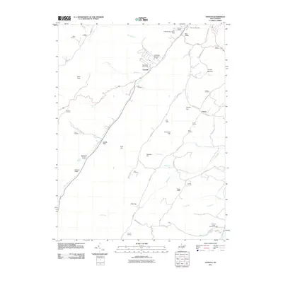
2011 Map of Antioch
USGS Topo · Published 2011About this map
New Creek flows through the center of this terrain, following a valley corridor that connects the settlements of Claysville, Laurel Dale, and the village of New Creek. The landscape is defined by its numerous gaps and ridges, including Hamricks Gap, Dolls Gap, and Grayson Gap, which dictate the winding paths of local roads like Knobley Rd and Penneroil Rd. For genealogists, the map is particularly dense with family-named burial sites, such as the Tasker Cemetery, Ward Cemetery, and Ferrbee Cemetery, often tucked away near watercourses like Mikes Run and Whip Run.
Find a feature on this map
61 named features on this map. Tap any name to fly to it.
Don’t see what you’re looking for? This feature index may not catch every label — zoom into the map to look around manually.
Map Details
Editions of this 2011 Antioch Map
This is the sole edition of this map. No revisions or reprints were ever made.
Other maps of this area

1891 · Romney
USGS Topo · 1:125,000

1895 · Piedmont
USGS Topo · 1:125,000

1919 · Elk Garden
USGS Topo · 1:48,000

1920 · Elk Garden
USGS Topo · 1:48,000

1920 · Moorefield
USGS Topo · 1:62,500

1920 · Keyser
USGS Topo · 1:62,500

1921 · Keyser
USGS Topo · 1:48,000

1921 · Greenland Gap
USGS Topo · 1:62,500

1921 · Moorefield
USGS Topo · 1:48,000

1922 · Elk Garden
USGS Topo · 1:62,500