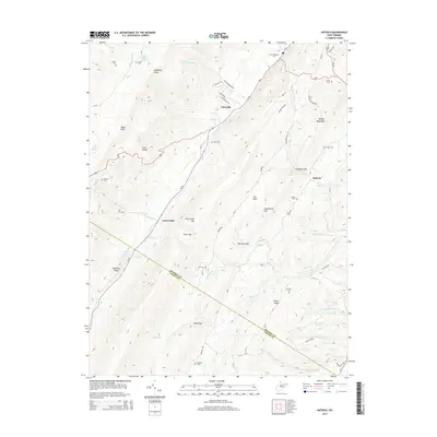
2014 Map of Antioch
USGS Topo · Published 2014About this map
Claysville and Laurel Dale sit along the winding path of Us-50 as it traverses the complex topography of the Allegheny Front. This 2014 survey documents the enduring rural character of the Mineral and Grant County border, defined by massive geological structures like Knobly Mountain and New Creek Mtn. The landscape is etched with numerous named springs such as Mineral County Spring, Elk Garden Spring, and Liller Farm Spring, which feed the many runs that drain the deep mountain gaps. A remarkable density of family-named burial grounds is recorded across these slopes, from Tasker Cem and McDonald Cem in the north to Knobley Cem in the south, providing a detailed spatial record for genealogical research. The intersection of early transportation routes and the natural terrain is evident at Grayson Gap and Chamberlin Gap, where local roads adapt to the steep ridgelines.
Find a feature on this map
77 named features on this map. Tap any name to fly to it.
Don’t see what you’re looking for? This feature index may not catch every label — zoom into the map to look around manually.
Map Details
Editions of this 2014 Antioch Map
This is the sole edition of this map. No revisions or reprints were ever made.
Other maps of this area

1891 · Romney
USGS Topo · 1:125,000

1895 · Piedmont
USGS Topo · 1:125,000

1919 · Elk Garden
USGS Topo · 1:48,000

1920 · Elk Garden
USGS Topo · 1:48,000

1920 · Moorefield
USGS Topo · 1:62,500

1920 · Keyser
USGS Topo · 1:62,500

1921 · Keyser
USGS Topo · 1:48,000

1921 · Greenland Gap
USGS Topo · 1:62,500

1921 · Moorefield
USGS Topo · 1:48,000

1922 · Elk Garden
USGS Topo · 1:62,500