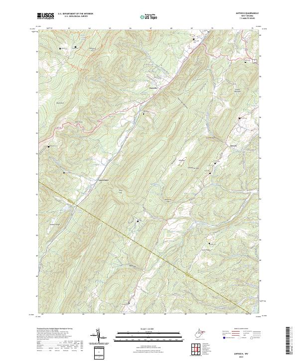
2023 Map of Antioch
USGS Topo · Published 2023About this map
Claysville and Antioch sit within a high ridge-and-valley landscape where the Mineral County and Grant County line crosses steep terrain. This 2023 edition reveals a rural network defined by the massive spine of New Creek Mountain and the parallel Knobly Mountain. Historically significant family sites are documented throughout the valleys, including the McDonald Cem near the northern border and the Knobley Cem to the south.
Find a feature on this map
90 named features on this map. Tap any name to fly to it.
Don’t see what you’re looking for? This feature index may not catch every label — zoom into the map to look around manually.
Map Details
Editions of this 2023 Antioch Map
This is the sole edition of this map. No revisions or reprints were ever made.
Other maps of this area

1891 · Romney
USGS Topo · 1:125,000

1895 · Piedmont
USGS Topo · 1:125,000

1919 · Elk Garden
USGS Topo · 1:48,000

1920 · Elk Garden
USGS Topo · 1:48,000

1920 · Moorefield
USGS Topo · 1:62,500

1920 · Keyser
USGS Topo · 1:62,500

1921 · Keyser
USGS Topo · 1:48,000

1921 · Greenland Gap
USGS Topo · 1:62,500

1921 · Moorefield
USGS Topo · 1:48,000

1922 · Elk Garden
USGS Topo · 1:62,500