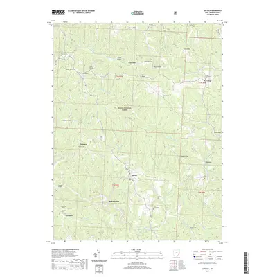
2019 Map of Antioch
USGS Topo · Published 2019About this map
The Antioch community and its surrounding ridges define this portion of Monroe County, where the topography is deeply carved by the Little Muskingum River and its numerous tributaries. Settled along the high ground and narrow valley floors, small hamlets like Mechanicsburg, Plainview, and Laings are connected by a network of rural roads such as Co Hwy 28 and Co Hwy 85. The landscape is dotted with numerous small burial grounds and rural houses of worship, including the Moffett Methodist Cem and the Unity Baptist Cem, reflecting the area's deep-rooted family history. Much of the western half of the quadrangle is protected within the Wayne National Forest, where steep terrain features like Paulas Ridge and Griffith Ridge rise above hollows like Grant Hollow. Notable landmarks such as Foraker Bridge and the small waters of Lake Glen mark the local geography.
Find a feature on this map
67 named features on this map. Tap any name to fly to it.
Don’t see what you’re looking for? This feature index may not catch every label — zoom into the map to look around manually.
Map Details
Editions of this 2019 Antioch Map
This is the sole edition of this map. No revisions or reprints were ever made.
Other maps of this area

1905 · Clarington
USGS Topo · 1:62,500

1905 · New Matamoras
USGS Topo · 1:62,500

1905 · Woodsfield
USGS Topo · 1:62,500

1906 · New Martinsville
USGS Topo · 1:62,500

1924 · New Martinsville
USGS Topo · 1:62,500

1924 · New Matamoras
USGS Topo · 1:62,500

1926 · New Martinsville
USGS Topo · 1:62,500

1926 · New Matamoras
USGS Topo · 1:62,500

1935 · Clarington
USGS Topo · 1:62,500

1940 · Clarington
USGS Topo · 1:62,500