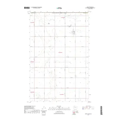
2017 Map of Antler
USGS Topo · Published 2017About this map
Antler sits at the northern edge of Bottineau Co, just south of the United States of America / Canada border. This North Dakota landscape is defined by the section-line grid of roads like 30th Ave NW and 109th St NW that partition the prairie. Local history is anchored by the Antler Cem and Saint Mary's Cem, which serve as primary records of the families that settled this borderland region. The terrain is marked by subtle drainage features such as Hulse Coulee, which meanders through the northwest. The map provides a detailed view of the town's small-scale street grid, including Main St and Gertrude St, showing the town's compact footprint within the expansive agricultural landscape of the high plains.
Find a feature on this map
34 named features on this map. Tap any name to fly to it.
Don’t see what you’re looking for? This feature index may not catch every label — zoom into the map to look around manually.
Map Details
Editions of this 2017 Antler Map
This is the sole edition of this map. No revisions or reprints were ever made.
Other maps of this area

1948 · Dokken SW
USGS Topo · 1:24,000

1949 · Westhope SW
USGS Topo · 1:24,000

1950 · Westhope SW
USGS Topo · 1:24,000

1950 · Antler NW
USGS Topo · 1:24,000

1950 · Antler
USGS Topo · 1:24,000
1950 · Renville
USGS Topo · 1:24,000
1951 · Kuroki
USGS Topo · 1:24,000

1954 · Minot
USGS Topo · 1:250,000

1958 · Minot
USGS Topo · 1:250,000
2011 · Renville
USGS Topo · 1:24,000