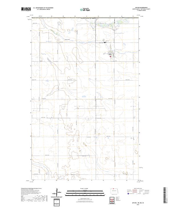
2024 Map of Antler
USGS Topo · Published 2024About this map
The northern edge of the United States of America defines the border of this prairie landscape, where the small community of Antler sits just south of the international line. Established in the early 1900s, the town's grid remains visible, anchored by Main St and Gertrude St. The surrounding Bottineau County countryside is marked by a vast network of section-line roads, such as Co Rd 2 and 109th St NW, which navigate the subtle undulations of the terrain and the drainage of Hulse Coulee. Genealogists will find particular value in the documentation of local resting places, including Antler Cem and Saint Mary's Cem located northwest of the town site. The map illustrates a classic Great Plains settlement pattern, where small rural hubs provided essential services to the surrounding agricultural townships.
Find a feature on this map
31 named features on this map. Tap any name to fly to it.
Don’t see what you’re looking for? This feature index may not catch every label — zoom into the map to look around manually.
Map Details
Editions of this 2024 Antler Map
This is the sole edition of this map. No revisions or reprints were ever made.
Other maps of this area

1948 · Dokken SW
USGS Topo · 1:24,000

1949 · Westhope SW
USGS Topo · 1:24,000

1950 · Westhope SW
USGS Topo · 1:24,000

1950 · Antler NW
USGS Topo · 1:24,000

1950 · Antler
USGS Topo · 1:24,000
1950 · Renville
USGS Topo · 1:24,000
1951 · Kuroki
USGS Topo · 1:24,000

1954 · Minot
USGS Topo · 1:250,000

1958 · Minot
USGS Topo · 1:250,000
2011 · Renville
USGS Topo · 1:24,000