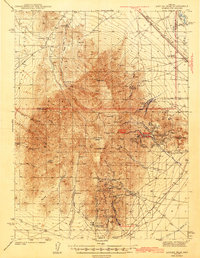
1943 Map of Antler Peak
USGS Topo · Published 1943About this map
The mining landscape of the Battle Mountain range is heavily detailed in this 1940 survey, which captures the industrial activity of Lander and Humboldt counties during the early 1940s. High-elevation operations like the Lucky Strike Mine and Copper Queen Mine punctuate the ridges near Antler Peak, while the southeastern slopes around Galena Canyon reveal a dense concentration of claims including the Butte Mine and the Nevada Mine. Settlement is primarily industrial or agricultural, ranging from the remote Oyarbide Ranch and Healy Cabins to organized worker outposts such as Buckingham Camp and the Copper Canyon Placer Camp. Along the northern edge, the transportation corridor of the Southern Pacific railroad and the Victory Highway follows the valley near the Reese River, connecting the town of Mote to the broader regional network of the Great Basin.
Find a feature on this map
70 named features on this map. Tap any name to fly to it.
Don’t see what you’re looking for? This feature index may not catch every label — zoom into the map to look around manually.
Map Details
Editions of this 1943 Antler Peak Map
3 editions found
Other maps of this area

1932 · Sonoma Range
USGS Topo · 1:250,000

1939 · Sonoma Range
USGS Topo · 1:250,000

1940 · Antler Peak
USGS Topo · 1:62,500

1943 · Antler Peak
USGS Topo · 1:62,500

1949 · Mt. Lewis
USGS Topo · 1:62,500

1950 · Mt. Lewis
USGS Topo · 1:62,500

1955 · Winnemucca
USGS Topo · 1:250,000

1957 · Battle Mountain
USGS Topo · 1:62,500

1958 · Winnemucca
USGS Topo · 1:250,000

1961 · McCoy
USGS Topo · 1:62,500