
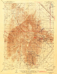
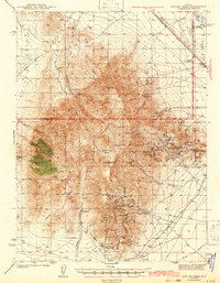
1943 Map of Antler Peak
USGS Topo · Published 1943About this map
Battle Mountain dominates this 1940s landscape, serving as a hub for intensive mining operations and high-desert ranching. The map reveals an intricate network of industrial claims and processing sites, including the Marigold Mine and the Dewitt Mill. The southeastern slopes are particularly dense with activity, centered around Buckingham Camp and the Copper Canyon Placer Camp, where specialized operations like the Dahl Placer and Iron Canyon Mine are situated.
Find a feature on this map
64 named features on this map. Tap any name to fly to it.
Don’t see what you’re looking for? This feature index may not catch every label — zoom into the map to look around manually.
Map Details
Editions of this 1943 Antler Peak Map
3 editions found
Other maps of this area

1932 · Sonoma Range
USGS Topo · 1:250,000

1939 · Sonoma Range
USGS Topo · 1:250,000

1940 · Antler Peak
USGS Topo · 1:62,500

1949 · Mt. Lewis
USGS Topo · 1:62,500

1950 · Mt. Lewis
USGS Topo · 1:62,500

1955 · Winnemucca
USGS Topo · 1:250,000

1957 · Battle Mountain
USGS Topo · 1:62,500

1958 · Winnemucca
USGS Topo · 1:250,000

1961 · McCoy
USGS Topo · 1:62,500

1962 · Winnemucca
USGS Topo · 1:250,000