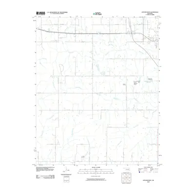
2009 Map of Antlers West
USGS Topo · Published 2009About this map
Coffee Creek and Beaver Creek wind through this landscape west of Antlers, where the rural character of Pushmataha County is defined by a dense network of sectional roads and small-scale water management. The terrain is marked by numerous small tributaries, including Dumpling Creek and Charlie Creek, which drain into larger basins regulated by structures like the Krebs Lake Dam and the Oknoname 127002 Reservoir.
Find a feature on this map
46 named features on this map. Tap any name to fly to it.
Don’t see what you’re looking for? This feature index may not catch every label — zoom into the map to look around manually.
Map Details
Editions of this 2009 Antlers West Map
This is the sole edition of this map. No revisions or reprints were ever made.
Other maps of this area

1901 · Antlers
USGS Topo · 1:125,000

1912 · Antlers
USGS Topo · 1:125,000

1925 · Antlers
USGS Topo · 1:125,000

1950 · Mcalester
USGS Topo · 1:250,000

1957 · Farris
USGS Topo · 1:24,000

1957 · Moyers
USGS Topo · 1:24,000
1961 · Darwin
USGS Topo · 1:24,000

1961 · Antlers East
USGS Topo · 1:24,000

1961 · Antlers West
USGS Topo · 1:24,000

1962 · McAlester
USGS Topo · 1:250,000