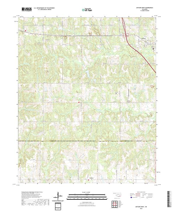
2022 Map of Antlers West
USGS Topo · Published 2022About this map
Antlers sits at the northeastern corner of this modern survey, where the township lines of t3s r16e and t4s r16e meet. The landscape is defined by the winding tributaries of the Kiamichi River basin, including the distinctive lowlands of Eamey Slash and the waters of Dumpling Cr. Near the southern border, the community of Nelson marks the transition into Choctaw Co, anchored by a network of rural roads such as Nelson Rd and E 1990 Rd. Local history and genealogy are represented by the Antlers City Cem and the more remote Hall Cem. Significant water features like Krebs Lake and the 127001 Reservoir highlight the area's water management, while the Antlers Municipal Airport serves as a modern transportation hub for this part of Pushmataha Co.
Find a feature on this map
51 named features on this map. Tap any name to fly to it.
Don’t see what you’re looking for? This feature index may not catch every label — zoom into the map to look around manually.
Map Details
Editions of this 2022 Antlers West Map
This is the sole edition of this map. No revisions or reprints were ever made.
Other maps of this area

1901 · Antlers
USGS Topo · 1:125,000

1912 · Antlers
USGS Topo · 1:125,000

1925 · Antlers
USGS Topo · 1:125,000

1950 · Mcalester
USGS Topo · 1:250,000

1957 · Farris
USGS Topo · 1:24,000

1957 · Moyers
USGS Topo · 1:24,000
1961 · Darwin
USGS Topo · 1:24,000

1961 · Antlers East
USGS Topo · 1:24,000

1961 · Antlers West
USGS Topo · 1:24,000

1962 · McAlester
USGS Topo · 1:250,000