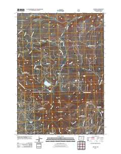
2011 Map of Antone
USGS Topo · Published 2011About this map
Antone (Historical) remains a significant marker of early settlement in Wheeler County, situated where the high-elevation ranching landscape meets the drainage of Rock Creek. This area was defined by its water management and early industry, evidenced by the extensive Philling-McFadden Ditch and Erickson Ditch that traverse the terrain near Erickson Ranch. The map captures a rugged topography punctuated by high points like Spanish Peak and the lookout at Windy Point, while family and local history is anchored by the Spanish Gulch Cemetery in the northeast. Small-scale water sources such as Edmonson Spring and Cottonwood Spring supported the livestock operations visible at Mascall Corrals, connected by a network of seasonal routes including the Mascall Jeep Trl. The presence of both Fred Creek Lake and Rock Creek Lake further illustrates the critical role of water storage in this high-desert environment.
Find a feature on this map
41 named features on this map. Tap any name to fly to it.
Don’t see what you’re looking for? This feature index may not catch every label — zoom into the map to look around manually.
Map Details
Editions of this 2011 Antone Map
This is the sole edition of this map. No revisions or reprints were ever made.
Other maps of this area

1932 · Dayville
USGS Topo · 1:125,000

1936 · Dayville
USGS Topo · 1:125,000

1953 · Richmond
USGS Topo · 1:62,500

1953 · Picture
USGS Topo · 1:62,500

1955 · Canyon City
USGS Topo · 1:250,000

1959 · Canyon City
USGS Topo · 1:250,000

1966 · Antone
USGS Topo · 1:24,000
1966 · Derr Meadows
USGS Topo · 1:24,000

1966 · Little Summit Prairie
USGS Topo · 1:24,000

1966 · Six Corners
USGS Topo · 1:24,000