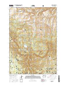
2017 Map of Antone
USGS Topo · Published 2017About this map
Mary Waterman Grave and the Spanish Gulch Cem offer specific points of interest for genealogists tracing family histories in this corner of Wheeler County. The landscape is defined by the high elevations of the Ochoco National Forest, where drainage systems like Fred Cr and Rock Cr carve through the terrain. Evidence of early water management is visible in the network of canals, including the Phillip-McFadden Ditch and Erickson Ditch, which redirect water through the valleys. The presence of the Antone Ranch Airport near Antone Ln suggests the importance of light aviation for remote ranching operations. From the heights of Spanish Peak down to Buck Pasture, the map documents a transition from forested peaks to the open gulches that once supported local prospecting and livestock.
Find a feature on this map
61 named features on this map. Tap any name to fly to it.
Don’t see what you’re looking for? This feature index may not catch every label — zoom into the map to look around manually.
Map Details
Editions of this 2017 Antone Map
This is the sole edition of this map. No revisions or reprints were ever made.
Other maps of this area

1932 · Dayville
USGS Topo · 1:125,000

1936 · Dayville
USGS Topo · 1:125,000

1953 · Richmond
USGS Topo · 1:62,500

1953 · Picture
USGS Topo · 1:62,500

1955 · Canyon City
USGS Topo · 1:250,000

1959 · Canyon City
USGS Topo · 1:250,000

1966 · Antone
USGS Topo · 1:24,000
1966 · Derr Meadows
USGS Topo · 1:24,000

1966 · Little Summit Prairie
USGS Topo · 1:24,000

1966 · Six Corners
USGS Topo · 1:24,000