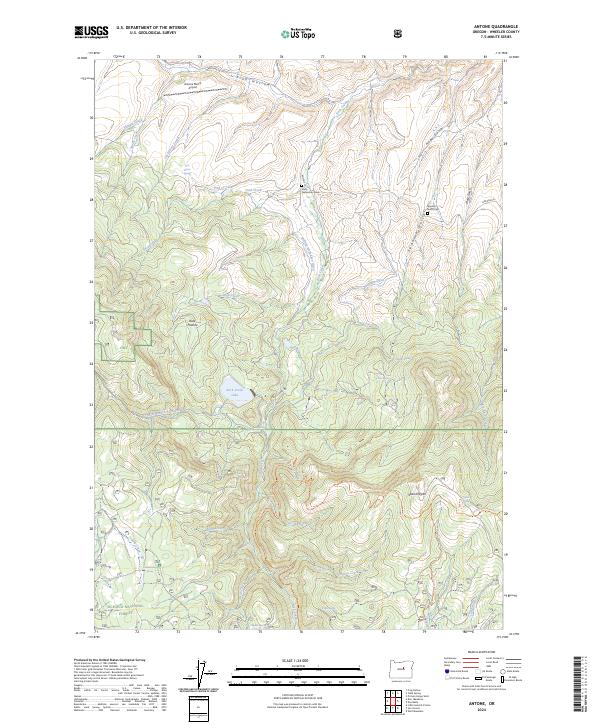
2024 Map of Antone
USGS Topo · Published 2024About this map
Spanish Gulch Cem and the solitary Mary Waterman Grave stand as quiet markers of early settlement history in this high-altitude reach of the Ochoco National Forest. The landscape is defined by its water management and grazing heritage, where features like the Phillip-McFadden Ditch and Erickson Ditch signify the effort to direct mountain runoff for ranching use. Local aviation is represented by the Antone Ranch Airport near Pine Hollow, serving a region where roads like Antone Ln provide limited access to the steep drainage systems of Rock Creek and Spanish Gulch. Rising above the surrounding gulches, the prominent Spanish Peak anchors the southeastern portion of the map. This terrain, characterized by springs like Ted Glover Spring and high-country meadows like Buck Pasture, reflects a traditional livestock and timber landscape that remains largely unchanged in its primary structure.
Find a feature on this map
58 named features on this map. Tap any name to fly to it.
Don’t see what you’re looking for? This feature index may not catch every label — zoom into the map to look around manually.
Map Details
Editions of this 2024 Antone Map
This is the sole edition of this map. No revisions or reprints were ever made.
Other maps of this area

1932 · Dayville
USGS Topo · 1:125,000

1936 · Dayville
USGS Topo · 1:125,000

1953 · Richmond
USGS Topo · 1:62,500

1953 · Picture
USGS Topo · 1:62,500

1955 · Canyon City
USGS Topo · 1:250,000

1959 · Canyon City
USGS Topo · 1:250,000

1966 · Antone
USGS Topo · 1:24,000
1966 · Derr Meadows
USGS Topo · 1:24,000

1966 · Little Summit Prairie
USGS Topo · 1:24,000

1966 · Six Corners
USGS Topo · 1:24,000