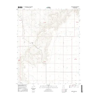
2017 Map of Apache Canyon
USGS Topo · Published 2017About this map
Apache Canyon provides a topographic anchor for this section of eastern New Mexico, where the high plains break into a network of drainage systems. The landscape is defined by the convergence of several waterways, including Apache Creek, Saladito Creek, and Revuelto Creek, which have carved distinct canyons into the terrain. Cultural evidence is concentrated near the canyon rims, most notably at the Brown Cem, a small burial ground situated north of the primary canyon floor.
Find a feature on this map
23 named features on this map. Tap any name to fly to it.
Don’t see what you’re looking for? This feature index may not catch every label — zoom into the map to look around manually.
Map Details
Editions of this 2017 Apache Canyon Map
This is the sole edition of this map. No revisions or reprints were ever made.
Other maps of this area

1930 · Tucumcari
USGS Topo · 1:125,000

1954 · Tucumcari
USGS Topo · 1:250,000

1954 · Clovis
USGS Topo · 1:250,000

1958 · Clovis
USGS Topo · 1:250,000

1958 · Tucumcari
USGS Topo · 1:250,000

1968 · San Jon
USGS Topo · 1:24,000

1968 · Bedford Hill
USGS Topo · 1:24,000
1968 · Tucumcari SE
USGS Topo · 1:24,000
1971 · Apache Canyon
USGS Topo · 1:24,000

1971 · Wheatland
USGS Topo · 1:24,000