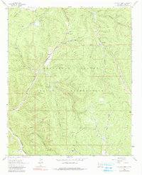
1963 Map of Apache Summit
USGS Topo · Published 1990About this map
The Mescalero Apache Indian Reservation encompasses this high-altitude landscape, where the Rio Tularosa and its various forks carve deep through the terrain. The presence of infrastructure such as the Apache Summit Radio Tower and Sewage Disposal Ponds near the summit indicates the localized development of this mountain pass during the early 1960s.
Find a feature on this map
38 named features on this map. Tap any name to fly to it.
Don’t see what you’re looking for? This feature index may not catch every label — zoom into the map to look around manually.
Map Details
Editions of this 1963 Apache Summit Map
Other maps of this area

1950 · Sierra Blanca Peak
USGS Topo · 1:62,500

1950 · Mescalero
USGS Topo · 1:62,500

1955 · Roswell
USGS Topo · 1:250,000

1958 · Roswell
USGS Topo · 1:250,000

1962 · Roswell
USGS Topo · 1:250,000

1963 · Ruidoso Downs
USGS Topo · 1:24,000

1963 · Ruidoso
USGS Topo · 1:24,000

1963 · Firman Canyon
USGS Topo · 1:24,000

1963 · Apache Summit
USGS Topo · 1:24,000
1963 · Whitetail
USGS Topo · 1:24,000