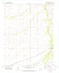
1970 Map of Apishapa Bridge
USGS Topo · Published 1973About this map
The Apishapa River winds through the southeastern corner of this arid landscape, defining the geographic focus of the area near the namesake Apishapa Bridge. This part of the plains is characterized by a network of drainage features, including Mustang Creek and the long course of Powell Arroyo, which cut through the high ground across the Pueblo and Otero County line.
Find a feature on this map
10 named features on this map. Tap any name to fly to it.
Don’t see what you’re looking for? This feature index may not catch every label — zoom into the map to look around manually.
Map Details
Editions of this 1970 Apishapa Bridge Map
3 editions found
Other maps of this area

1891 · Catlin
USGS Topo · 1:125,000

1891 · Timpas
USGS Topo · 1:125,000

1891 · Nepesta
USGS Topo · 1:125,000

1891 · Apishapa
USGS Topo · 1:125,000

1893 · Nepesta
USGS Topo · 1:125,000

1893 · Apishapa
USGS Topo · 1:125,000

1893 · Catlin
USGS Topo · 1:125,000

1894 · Timpas
USGS Topo · 1:125,000

1897 · Apishapa
USGS Topo · 1:125,000

1904 · Nepesta
USGS Topo · 1:125,000