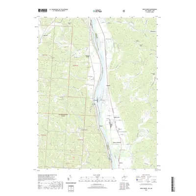
2019 Map of Apple Grove
USGS Topo · Published 2019About this map
Ohio River bottomlands and the rugged slopes of the Wayne National Forest define this 2019 survey of the border between Ohio and West Virginia. Along the western bank, the settlement of Eureka and the landmark Raccoon Island sit at the mouth of Raccoon Creek, where the terrain rises sharply into the wooded draws of Shoestring Ridge. This landscape is particularly rich for genealogical research, documenting numerous family and church burial grounds such as Cottrell Cem, McLelion Cem, and the Bethel Methodist Episcopal Cemetery. Across the river in Mason County, West Virginia, the map tracks the linear development of Hogsett and Apple Grove along the Huntington Road corridor. The layout of Mercers Bottom and the presence of Apple Grove Memorial Gardens illustrate the continued importance of the narrow fertile plains between the river and the steep hills of Mt Carmel Ridge.
Find a feature on this map
104 named features on this map. Tap any name to fly to it.
Don’t see what you’re looking for? This feature index may not catch every label — zoom into the map to look around manually.
Map Details
Editions of this 2019 Apple Grove Map
This is the sole edition of this map. No revisions or reprints were ever made.
Other maps of this area

1906 · Bidwell
USGS Topo · 1:62,500

1906 · Athalia
USGS Topo · 1:62,500

1906 · Glenwood
USGS Topo · 1:62,500

1908 · Bidwell
USGS Topo · 1:62,500

1908 · Athalia
USGS Topo · 1:62,500

1908 · Glenwood
USGS Topo · 1:62,500

1908 · Point Pleasant
USGS Topo · 1:62,500

1926 · Point Pleasant
USGS Topo · 1:62,500

1929 · Point Pleasant
USGS Topo · 1:62,500

1957 · Beech Hill
USGS Topo · 1:24,000