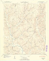
1950 Map of Appleton
USGS Topo · Published 1950About this map
Sugar Creek and its many tributaries, including East Fork Sugar Creek and West Fork Sugar Creek, carve a dense network of hollows across the border of Lawrence and Giles counties. This mid-century landscape is defined by small rural hubs and crossroad settlements like Appleton, Minor Hill, and Sexton. The map reveals a deeply rooted social geography, where community life centered around local landmarks such as Williams Store and numerous country institutions like Booth Chapel and Puncheon Church. Local family history is preserved in the numerous burial grounds and schoolhouses dotting the hills, including Noblit Cem, Oxford Cem, and the Concord Sch. The terrain is notably marked by the Sam Davis Monument, standing near the intersection of various creek forks and ridges like White Ridge, which dictated the winding paths of the early road system through Rackley Hollow and Miller Hollow.
Find a feature on this map
74 named features on this map. Tap any name to fly to it.
Don’t see what you’re looking for? This feature index may not catch every label — zoom into the map to look around manually.
Map Details
Editions of this 1950 Appleton Map
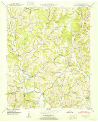
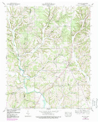
3 editions found
Other maps of this area

1914 · Rogersville
USGS Topo · 1:48,000

1916 · Rogersville
USGS Topo · 1:62,500

1936 · Union Hill
USGS Topo · 1:24,000

1936 · Aspen Hill
USGS Topo · 1:24,000

1936 · Lexington
USGS Topo · 1:24,000

1936 · Lawrenceburg
USGS Topo · 1:24,000

1936 · Pulaski
USGS Topo · 1:24,000

1936 · Bodenham
USGS Topo · 1:24,000

1936 · Appleton
USGS Topo · 1:24,000

1936 · Bonnertown
USGS Topo · 1:24,000