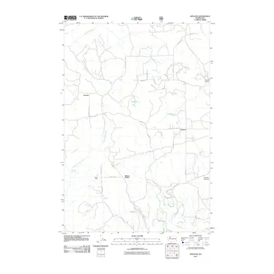
2011 Map of Appleton
USGS Topo · Published 2011About this map
Appleton and Snowden serve as the primary anchors of this Klickitat County landscape, which is defined by a dense network of local roads and named water sources. The terrain is notably water-rich, featuring several named springs such as Ellard Spring, Blove Spring, and McGowen Spring, alongside significant drainages like Rattlesnake Creek and East Fork Major Creek. This survey reveals a community structure tied to both ranching and forestry, evidenced by features like Graves Dam and Beaver Pond.
Find a feature on this map
55 named features on this map. Tap any name to fly to it.
Don’t see what you’re looking for? This feature index may not catch every label — zoom into the map to look around manually.
Map Details
Editions of this 2011 Appleton Map
This is the sole edition of this map. No revisions or reprints were ever made.
Other maps of this area

1934 · The Dalles
USGS Topo · 1:125,000

1953 · The Dalles
USGS Topo · 1:250,000

1956 · The Dalles
USGS Topo · 1:250,000

1957 · The Dalles
USGS Topo · 1:250,000

1957 · Klickitat
USGS Topo · 1:62,500

1957 · The Dalles
USGS Topo · 1:62,500

1957 · White Salmon
USGS Topo · 1:62,500

1957 · Husum
USGS Topo · 1:62,500

1974 · The Dalles North
USGS Topo · 1:24,000
1975 · Lyle
USGS Topo · 1:24,000