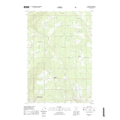
2020 Map of Appleton
USGS Topo · Published 2020About this map
Appleton and Klickitat Heights serve as the primary hubs for this region of Klickitat County, where a complex network of forest and ranch roads like Moonshine Rd and Rustic Rd crisscross the landscape. The southern portion of the sheet transitions into the protected timberlands of the Gifford Pinchot National Forest, a terrain marked by numerous water sources including McGowen Spring and Curl Spring.
Find a feature on this map
59 named features on this map. Tap any name to fly to it.
Don’t see what you’re looking for? This feature index may not catch every label — zoom into the map to look around manually.
Map Details
Editions of this 2020 Appleton Map
This is the sole edition of this map. No revisions or reprints were ever made.
Other maps of this area

1934 · The Dalles
USGS Topo · 1:125,000

1953 · The Dalles
USGS Topo · 1:250,000

1956 · The Dalles
USGS Topo · 1:250,000

1957 · The Dalles
USGS Topo · 1:250,000

1957 · Klickitat
USGS Topo · 1:62,500

1957 · The Dalles
USGS Topo · 1:62,500

1957 · White Salmon
USGS Topo · 1:62,500

1957 · Husum
USGS Topo · 1:62,500

1974 · The Dalles North
USGS Topo · 1:24,000
1975 · Lyle
USGS Topo · 1:24,000